
ENVEO offers products and services for several key applications in the following fields:
|
|
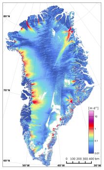
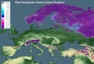
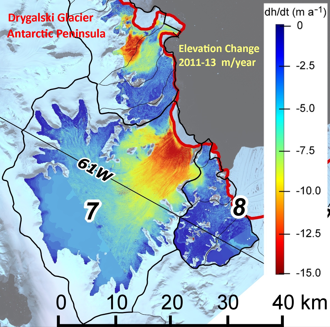
Satellite Data ExploitationDevelopment of Processing Tools for Exploitation of Radar and Optical Sensors Topographic Corrections for Radar and Optical Satellite Imagery Validation and Quality Assessment of Radar and Optical Satellite Products Snow Cover and Glacier Products from Regional to Global Scale Ice Velocity Maps for Greenland, Antarctica and Mountain Glaciers Maps of Surface Elevation Change Mapping and Monitoring Surface Deformation on Mountain Slopes Maps of Quality Parameters for Inland Water |
|
|
Modelling and Forecasting ServicesGlacier Mass Balance and Runoff Snowmelt Runoff Snow Cover Dynamics |
|
|
ConsultancyNew Satellite Techniques for Snow and Ice Monitoring Concepts for EO Satellite Formations in Climate Monitoring Support for Geotechnical Projects in Mountain Regions Satellite Techniques for Hydrology and Water Management |
We provide competent solutions tailored to your specific needs. Feel free to contact us for questions.